Theodore
I gotta move
Holland terminal

McLean - Just inside McLean county after about 68 miles.

Stopped in Atlanta long enough to get blasted with a storm siren test. Crapola, that hurt. From there I traced back over that detour and decided to stay off 66 for a while longer but missed a turn on the map and ended up on some roads with bigass loose rock. Fun.

In Lincoln, platted by the man himself and named for him before he was president.


Stopped at McD's here (sorry health thread) and had my first Big Mac in ages. No wallet in my pocket (I wear regular shorts over bike shorts) on the way in. No surprise whatsoever and I went out and picked it up in the parking lot. Camera fell out of my pocket on the way into town and almost came apart. Pretty much obligatory as well; still works.
  Used my small town-level bike lock for the first time while I went into McD and ate under one of their trees.

Wasn't too tired and strayed from 66 again.

The preparation plant mentioned earlier.


Just south of Elkhart. I meant to get back on 66 at Elkhart but realized I would have to go right over Elkhart Hill, which is part of a glacial moraine. Didn't know how far I had ridden but knew it was really far and didn't know how steep it was but knew it was pretty steep, so I kept on going and added a few miles. Unless you take a well-trafficked main road around here you're going to do a lot of right angles as most of the back roads are on a grid. When I mapped it later on mapmyride it turned out I had ridden 104 miles and the grade on the hill got up to 11%. Fuuuu. Totally made the right call on skipping it. Here's the conveyor I mentioned earlier and an old cattle baron estate. Lot of history and prehistory here as it's a natural landmark on the prairie. Same foot trail that was used by Indians- French-British-Americans and goes over the hill also ran right next to the creek I live next to south of Springfield. http://illinoistimes.com/article-5781-the-view-from-elkhart-hill.html


Sangamon River, far north side of Springfield: about 23 miles to go. I had stopped about 8 miles before this to wait on some potential rain and I was pretty wiped out after that. Slight headwind part of the way back, which didn't help. Stopped at MWGL favorite Taco Bell on the south side and powered through the rail trail at about my usual speed but kind of crawled after that. Got home around 7, which wasn't bad after many stops and added miles. No desire to do that much again but I'll probably get close. With about 12 or 13 miles to go some kid on a bike asked me if I wanted to race.


I did 20 miles round trip to my usual grocery store last night (car not fixed yet) and that was almost as adventurous. Really need panniers. My backpack was stuffed beyond capacity and I ended up with two frozen burritos in my pocket, one of which I dropped on the road of course.

McLean - Just inside McLean county after about 68 miles.

Stopped in Atlanta long enough to get blasted with a storm siren test. Crapola, that hurt. From there I traced back over that detour and decided to stay off 66 for a while longer but missed a turn on the map and ended up on some roads with bigass loose rock. Fun.

In Lincoln, platted by the man himself and named for him before he was president.


Stopped at McD's here (sorry health thread) and had my first Big Mac in ages. No wallet in my pocket (I wear regular shorts over bike shorts) on the way in. No surprise whatsoever and I went out and picked it up in the parking lot.
 Camera fell out of my pocket on the way into town and almost came apart. Pretty much obligatory as well; still works.
  Used my small town-level bike lock for the first time while I went into McD and ate under one of their trees.
Wasn't too tired and strayed from 66 again.

The preparation plant mentioned earlier.


Just south of Elkhart. I meant to get back on 66 at Elkhart but realized I would have to go right over Elkhart Hill, which is part of a glacial moraine. Didn't know how far I had ridden but knew it was really far and didn't know how steep it was but knew it was pretty steep, so I kept on going and added a few miles. Unless you take a well-trafficked main road around here you're going to do a lot of right angles as most of the back roads are on a grid. When I mapped it later on mapmyride it turned out I had ridden 104 miles and the grade on the hill got up to 11%. Fuuuu. Totally made the right call on skipping it. Here's the conveyor I mentioned earlier and an old cattle baron estate. Lot of history and prehistory here as it's a natural landmark on the prairie. Same foot trail that was used by Indians- French-British-Americans and goes over the hill also ran right next to the creek I live next to south of Springfield. http://illinoistimes.com/article-5781-the-view-from-elkhart-hill.html


Sangamon River, far north side of Springfield: about 23 miles to go. I had stopped about 8 miles before this to wait on some potential rain and I was pretty wiped out after that. Slight headwind part of the way back, which didn't help. Stopped at MWGL favorite Taco Bell on the south side and powered through the rail trail at about my usual speed but kind of crawled after that. Got home around 7, which wasn't bad after many stops and added miles. No desire to do that much again but I'll probably get close. With about 12 or 13 miles to go some kid on a bike asked me if I wanted to race.


I did 20 miles round trip to my usual grocery store last night (car not fixed yet) and that was almost as adventurous.
 Really need panniers. My backpack was stuffed beyond capacity and I ended up with two frozen burritos in my pocket, one of which I dropped on the road of course.
Last edited:

 Around here, summer is our off season, much like winter is for most of you.


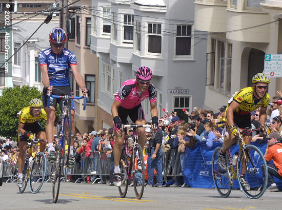
 And hard is relative. Theodore, your 145 mile ride would be very hard for me even with no elevation and light winds since it is just so long. I'm going for about 3 hours max and then I start to degrade (those back/knees/necks that I mentioned start to be more than just sore). And if you can ride 145 a few miles of 7/8% grades shouldn't be a problem. This would probably be much easier for you than your 145 miles would be for me that's for sure. And I totally agree with SVL, you earn the downhills. The ride below has a cat 2 climb in it. 1200' at 8% for 3 miles. I need the downhill to recover...
